What AI thinks about GPS tracking or iVMS
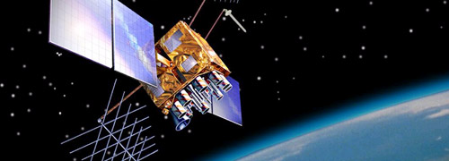
The Global Positioning System (GPS) is a satellite-based navigation system that provides location and time information in all weather conditions, anywhere on or near the Earth. Developed by the United States government, it is composed of a network of satellites orbiting the Earth, ground control stations, and GPS receivers that pick up the signals from the satellites to determine the location of the receiver.
The GPS system was originally developed for military use, but it has since been made available for civilian use and has become an integral part of our daily lives. It is used for a wide range of applications, such as navigation for vehicles, boats, and aircraft, tracking of vehicles and assets, surveying and mapping, and timing for financial transactions, power grids, and telecommunications networks.
The GPS system is based on a network of satellites orbiting the Earth at an altitude of approximately 20,200km. There are currently 31 operational satellites in the GPS constellation, with a minimum of 24 satellites in view from any point on the Earth’s surface. Each satellite transmits a signal that includes the satellite’s location and the current time, which is picked up by GPS receivers on the ground.
GPS receivers use the signals from at least four satellites to determine the user’s location and calculate the current time. By measuring the distance to each satellite using the time it takes for the signal to travel from the satellite to the receiver, the receiver can determine its own location by triangulation. The receiver can then use this information to provide a wide range of location-based services, such as navigation and tracking.
The GPS system also includes a network of ground control stations, which are used to monitor the health and status of the satellites and to upload new data and software to the satellites. The system is maintained and operated by the United States Air Force.
One of the key advantages of GPS is its global coverage and the ability to provide precise location and time information. The system has an accuracy of about 5-10 meters for civilian users, and it can be further improved with the use of augmentation systems such as WAAS (Wide Area Augmentation System) and EGNOS (European Geostationary Navigation Overlay Service)
GPS technology is becoming increasingly important as society becomes more dependent on location-based services. With the development of new applications such as autonomous vehicles, the Internet of Things, and the smart city concept, the usage of GPS technology will continue to grow in the future.
In conclusion, The Global Positioning System (GPS) is a satellite-based navigation system that provides location and time information in all weather conditions, anywhere on or near the Earth. It’s a vital technology that has become an integral part of our daily lives, used in various applications such as navigation, tracking, mapping, and timing. With the growth in the field of technology, the future looks bright for GPS and the ways in which it can be used to improve our lives.
This article has been written by an AI of openai.com which known by ChatGPT
نظام تحديد المواقع العالمي (GPS) هو نظام ملاحة قائم على الأقمار الصناعية يوفر معلومات عن الموقع والوقت في جميع ظروف الطقس ، في أي مكان على الأرض أو بالقرب منها. تم تطويره من قبل حكومة الولايات المتحدة ، ويتكون من شبكة من الأقمار الصناعية التي تدور حول الأرض ومحطات التحكم الأرضية وأجهزة استقبال GPS التي تلتقط الإشارات من الأقمار الصناعية لتحديد موقع جهاز الاستقبال.
تم تطوير نظام GPS في الأصل للاستخدام العسكري ، ولكنه أصبح متاحًا منذ ذلك الحين للاستخدام المدني وأصبح جزءًا لا يتجزأ من حياتنا اليومية. يتم استخدامه لمجموعة واسعة من التطبيقات ، مثل الملاحة للمركبات والقوارب والطائرات ، وتتبع المركبات والأصول ، والمسح ورسم الخرائط ، وتوقيت المعاملات المالية ، وشبكات الطاقة ، وشبكات الاتصالات.
يعتمد نظام GPS على شبكة من الأقمار الصناعية تدور حول الأرض على ارتفاع 20200 كيلومتر تقريبًا. يوجد حاليًا 31 قمراً صناعياً عاملاً في كوكبة نظام تحديد المواقع العالمي (GPS) ، مع وجود ما لا يقل عن 24 قمراً صناعياً في مجال الرؤية من أي نقطة على سطح الأرض. يرسل كل قمر صناعي إشارة تتضمن موقع القمر الصناعي والوقت الحالي ، والتي يتم التقاطها بواسطة أجهزة استقبال GPS على الأرض.
تستخدم أجهزة استقبال GPS الإشارات من أربعة أقمار صناعية على الأقل لتحديد موقع المستخدم وحساب الوقت الحالي. من خلال قياس المسافة إلى كل قمر صناعي باستخدام الوقت الذي تستغرقه الإشارة للانتقال من القمر الصناعي إلى جهاز الاستقبال ، يمكن لجهاز الاستقبال تحديد موقعه عن طريق التثليث. يمكن للمستقبل بعد ذلك استخدام هذه المعلومات لتوفير مجموعة واسعة من الخدمات القائمة على الموقع ، مثل التنقل والتتبع.
يشتمل نظام GPS أيضًا على شبكة من محطات التحكم الأرضية ، والتي تُستخدم لمراقبة صحة وحالة الأقمار الصناعية وتحميل بيانات وبرامج جديدة على الأقمار الصناعية. يتم صيانة النظام وتشغيله من قبل القوات الجوية للولايات المتحدة.
تتمثل إحدى المزايا الرئيسية لنظام تحديد المواقع العالمي (GPS) في تغطيته العالمية والقدرة على توفير معلومات دقيقة عن الموقع والوقت. تبلغ دقة النظام حوالي 5-10 أمتار للمستخدمين المدنيين ، ويمكن تحسينه بشكل أكبر باستخدام أنظمة التعزيز مثل WAAS (نظام زيادة المساحة الواسعة) و EGNOS (خدمة تراكب الملاحة الأوروبية الثابتة بالنسبة للأرض)
أصبحت تقنية GPS ذات أهمية متزايدة حيث أصبح المجتمع أكثر اعتمادًا على الخدمات القائمة على الموقع. مع تطوير تطبيقات جديدة مثل المركبات ذاتية القيادة وإنترنت الأشياء ومفهوم المدينة الذكية ، سيستمر استخدام تقنية GPS في النمو في المستقبل.
في الختام ، فإن نظام تحديد المواقع العالمي (GPS) هو نظام ملاحة قائم على الأقمار الصناعية يوفر معلومات عن الموقع والوقت في جميع ظروف الطقس ، في أي مكان على الأرض أو بالقرب منها. إنها تقنية حيوية أصبحت جزءًا لا يتجزأ من حياتنا اليومية ، وتستخدم في تطبيقات مختلفة مثل التنقل والتتبع ورسم الخرائط والتوقيت. مع النمو في مجال التكنولوجيا ، يبدو المستقبل مشرقًا لنظام تحديد المواقع العالمي (GPS) والطرق التي يمكن من خلالها استخدامه لتحسين حياتنا.
Comments are closed.